
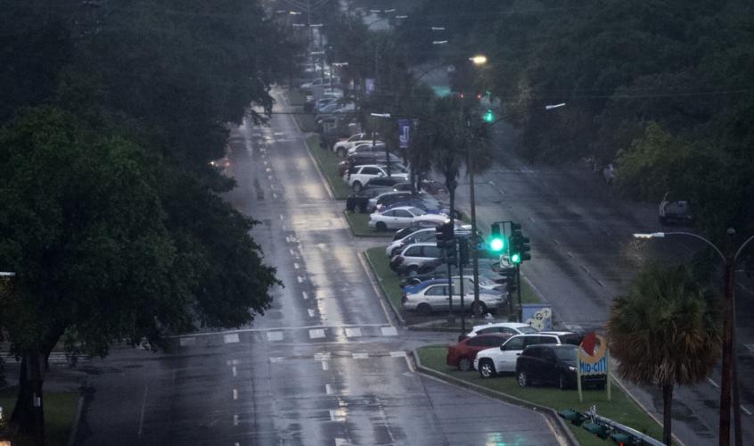

The city will lift its ban on parking cars on the neutral ground at 6 p.m. Sunday and is urging caution as Tropical Storm Beta moves toward the Texas coast, bringing with it potential for heavy rain, wind and coastal flooding outside the levee system.
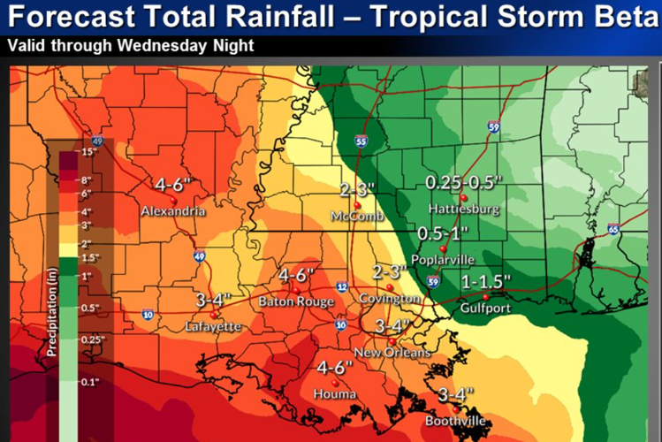
Forecasters say a band of heavy rainfall detached from the storm system is expected over south Louisiana by late Monday and rains could last through Wednesday, with the heaviest downpours likely to occur on Tuesday and Tuesday night.
The National Weather Service says the New Orleans metro area is at marginal risk of excessive rainfall over the next few days, with current projections forecasting 3-4 inches of rain in New Orleans and 2-3 inches of rain on the north shore.
While parking on the neutral ground will be allowed, residents are asked not to block intersections, streetcar tracks or bike paths.
A wind advisory is also in effect until 7 p.m., with gusts between 20 and 30 mph across much of southeast Louisiana south of Interstate 10. Trash cans, outdoor decorations and other loose items should be secured.
Venetian Isles, Lake Catherine and Irish Bayou, all outside of the city's flood protection system, could see water levels of one to three feet above normal from now until the middle of the week. A Coastal Flood Warning is in effect for those areas.
A Coastal Flood Warning is also in effect for St. John, St. Charles, St. Bernard, Plaquemines and Upper Jefferson parishes as well as Orleans. According to the National Weather Service, those areas could see minor to moderate coastal flooding — including inundation of up to 3 feet at high tide — that could make some low-lying coastal roads impassable.


